I was up in Gwaii Haanas for a couple ofd trips and managed to get five short paddles in.
June 2nd and 3rd - De La Beche Inlet
I managed to take guests out for an afternoon and an early morning paddle in De La Beche Inlet. Such a lovely spot with plenty of seals following us!
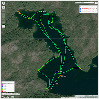 |
| click to enlarge - De La Beche |
6 km
June 9 - Dolomite Point
I managed to get out before and after breakfast for paddles with guests before heading to Dolomite (Burnaby Narrows)
I had a great encounter with a young seal who followed me for almost the entire paddle - it even came up and played with my paddle!
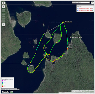 |
| click to enlarge - Dolomite point |
6 km
June 12 - Echo Harbour
We managed to get out for a short paddle before dinner in Echo Harbour. A lovely last paddle of the trip.
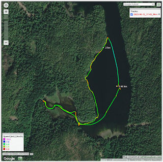 |
| click to enlarge - Echo Hbr |
2 km
All paddles
 |
| all tracks - click to enlarge |