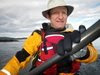
A shot of my etrex legend GPS in it's nimbus bracket on the deck of my CD gulfstream. It is displaying a chart as well as my speed and heading.
A shot of my etrex legend GPS in it's nimbus bracket on the deck of my CD gulfstream. It is displaying a chart as well as my speed and heading.
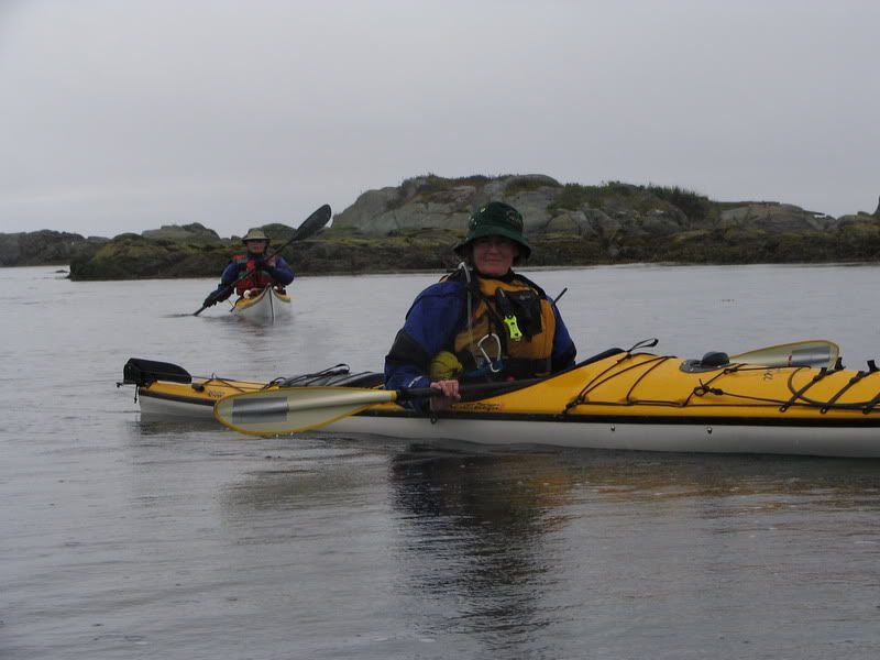
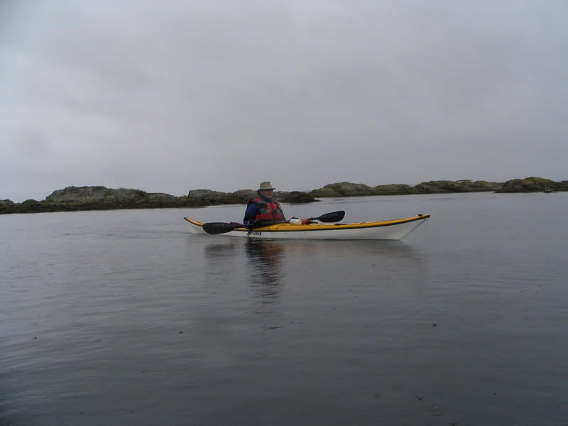
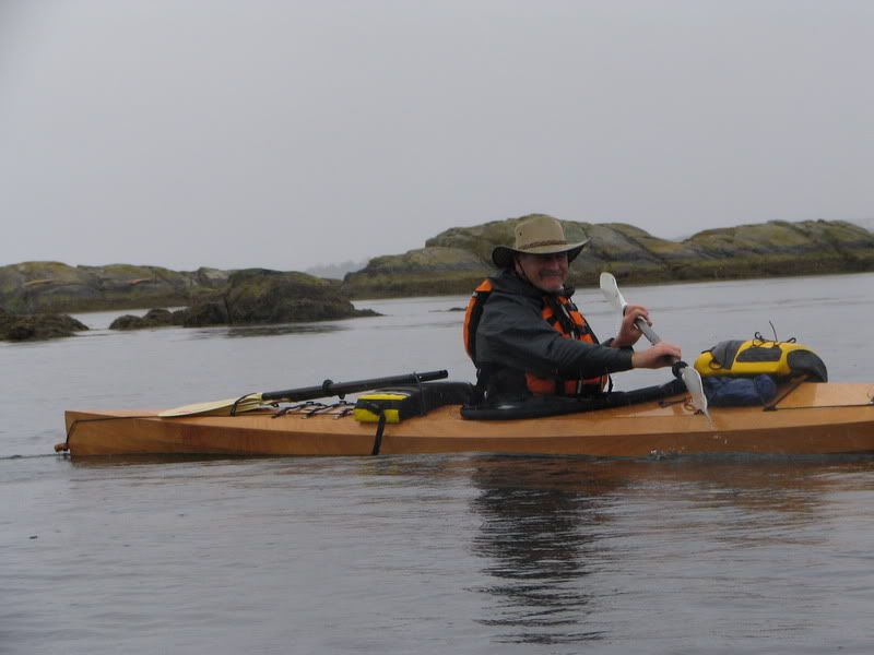
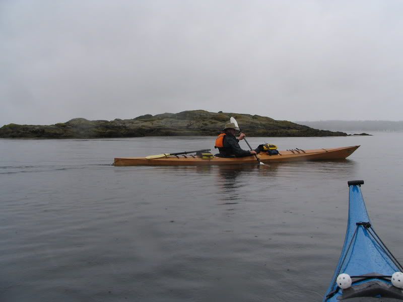
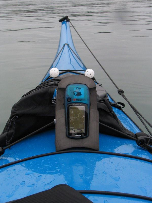
Mike, Craig and I set off early from Smuggler’s cove (7:30 AM!) to go play in Baynes. The current was ebbing quickly as predicted, but there were no significant standing waves. We played in the eddies and overfalls for a while and then decided to paddle around Discovery Island. It was a nice morning and it was nice to have had a great paddle and yet be done by noon.
Shots from today: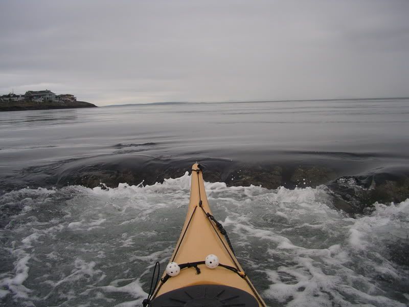
Our trip via google maps: http://www.islandnet.com/~mjackson/google/2006_05_27_baynesdiscovery.htm
Distance travelled 8.4 nm/15.6 km (YTD: 379 km)
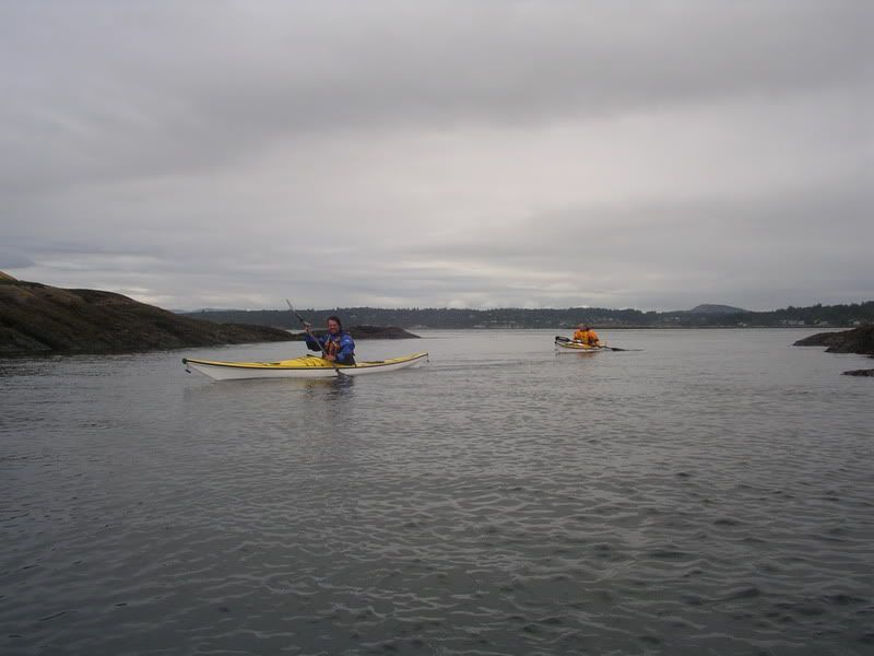
I went to the Deer Group for the weekend with Beth-Anne and a group of 8 grade 11 students (Margaret, Callie, Nicole, Charlotte, David, Kevin, Stephen and Daniel) from the school who were on an outdoor leadership trip. We overnighted at Bamfield school gym for our first night which worked out well. Margaret came down with a stomach flu or something and we spent much of the first day organsing and getting her returned home. We spent our second night at the Centennial Park campground. We had bear bamngers at the ready since there were definitely a few nosy bears around. We set off Sunday morning and paddled out to the Ross Islets for lunch and then paddled around the south side of Fleming and through Robbers passage and found a nice campsite in Marble cove. The second Day we paddled from Marble Cove around Tsartus Island and back through Robbers passage to another nice site on the northwest side of Fleming Island. On our last day we paddled back to Bamfield via the Ross islets and Wizard Islet. There were SE gales forecast throughout the trip, but these did not seem to materialise in our area.
Check out our track with Google Maps: http://www.islandnet.com/~mjackson/google/deergroup2006.htm
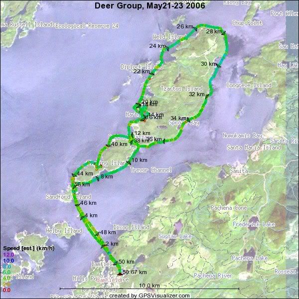 My usual gpsvisualizer track plot.
 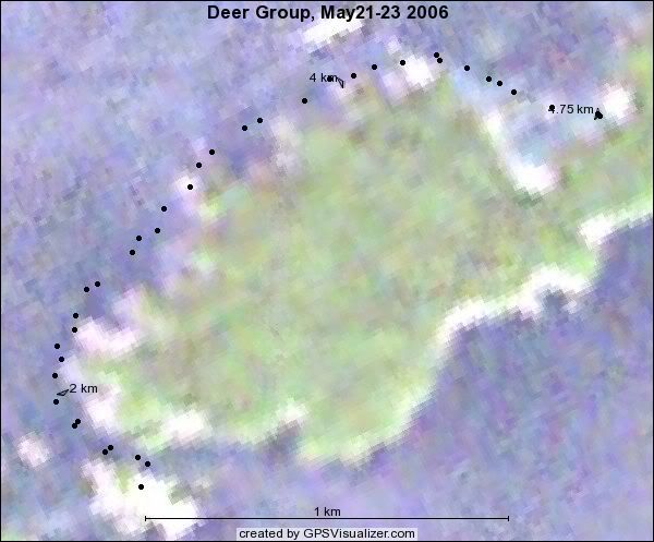 I also did an additional jaunt over to where our other group was camping on Ross Islets – forgot the GPS though!
(Total distance: 30 miles, 55 km, YTD 363 km)
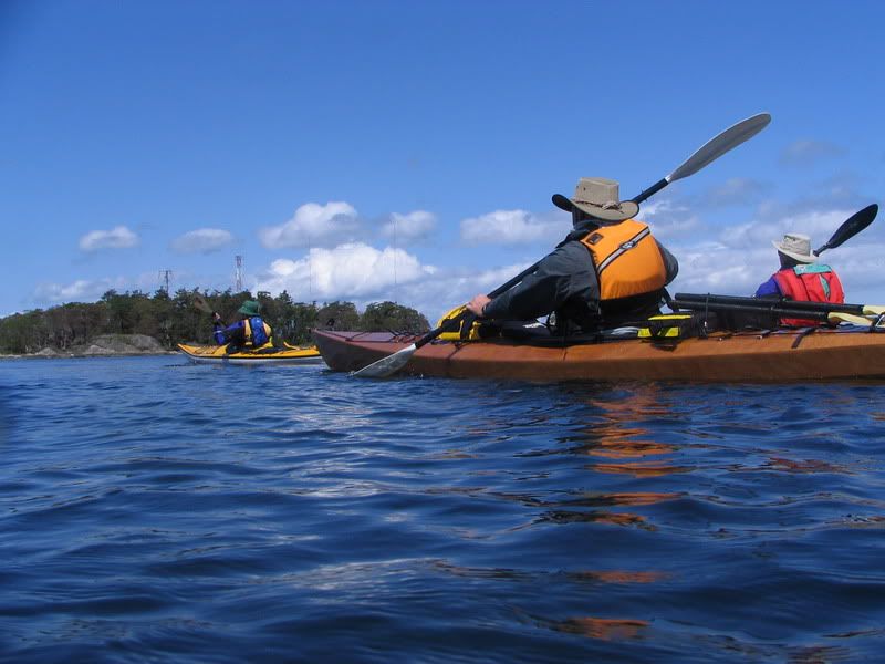
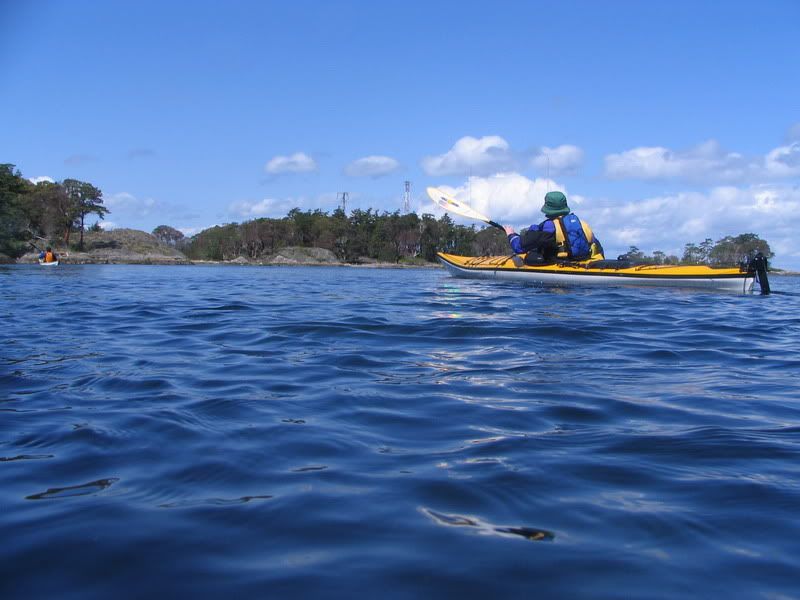
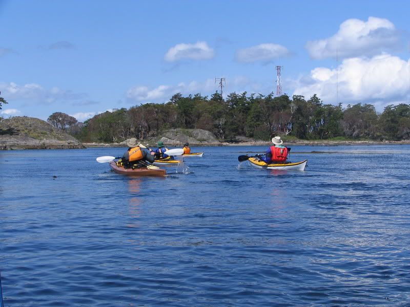
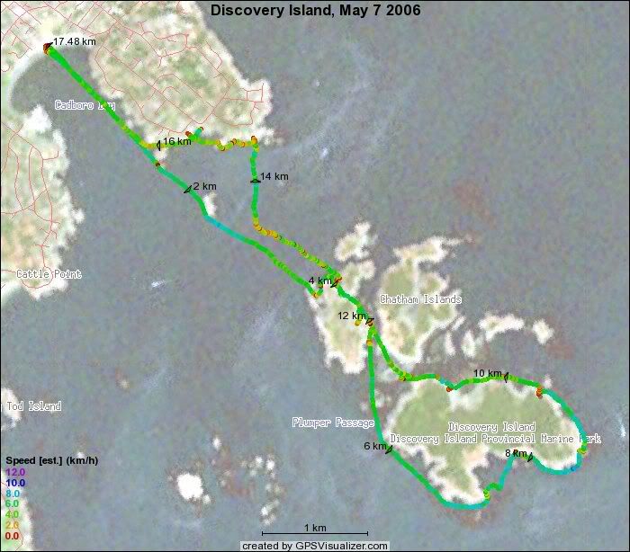
Paolo,Craig, Tony, Dennis, John, Susan and I set off in light rain from Cadboro Bay in the morning and paddled out to Chatham Islands. W decided to go around Discovery Island too. We ran into Mark, Darren and Carolyn who had camped over on Rudlin Bay. We had lunch in a nice protected cove just north of the Discovery light station. While we were eating, the sun came out and the wind picked up (as forecasted, though stronger than we had expected). This made the trip back to Cadboro Bay a bit of a slog – the wind was strong enough that many of us had trouble pointing into the wind. The section from Cadboro point to Flower Island was the toughest. The paddle wrapped up with hot coffee or chocolate at Olive Olios.