Monday, August 31, 2009

August 21 to 30 - North Island (#s 84 to 89)

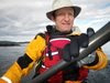
A brief report of our trip… will be posting more details and picytures and video soon


We (Pete, george, dennis and I) drove up to Port Hardy on Friday August 20th. We encountered some heavy rain near Sayward but this had pretty much stopped by the time we got to Hardy. After chatting with Pat from Odyssey Kayaking (http://www.odysseykayaking.com/)( a great help in many ways) we decided to overnight in Hardy at the North Coat trail Backpackers Hostel (http://www.porthardyhostel.webs.com/) and have a good meal at Sprty’s Bar and Grill (great food!). The folks at the hostel were friendly and the rates were good and it was just around the corner from Odyssey Kayaking and our planned launch spot.


Day 1 August 22nd – Port Hardy to Cape Sutil –


Day 2 August 23rd – Cape Sutil to Guise Bay -


Day 3 – August 24th Guise Bay – stormbound


Day 4 – August 25 – Guise Bay to Hanna Point


Day 5 – Hanna Point, Sea Otter Cove to San Josef Bay


Day 6 – San Josef Bay – stormbound


Day 7 – San Josef Bay to Grant Bay


Day 8 – Grant Bay to Coal Harbour


Our trip track log: ScreenShot190


The zoomable Google Maps track can be found at: http://www.islandnet.com/~mjackson/google/northisland2009trip.html


Total trip was 201 km, 108 NM, YTD 1033 km


Average moving speed: 5.6 kph, 3 knots. Moving time: 36 hours

Sunday, August 30, 2009

SPOT Messages from trip

I have condensed the spot messages into one posting: (some how I missed the message on August 22 at Cape Sutil…)


Friday, August 21, 2009 –  Port Hardy


Latitude:50.7207 Longitude:-127.4909
Time:08/21/2009 18:56:57 (America/Vancouver)
http://maps.google.com/maps?f=q&hl=en&geocode=&q=50.7207,-127.4909&ll=50.7207,-127.4909&ie=UTF8&z=12&om=1


Sunday, August 23, 2009 –  Guise Bay


Latitude:50.7714 Longitude:-128.4022
Time:08/23/2009 16:47:40 (America/Vancouver)
http://maps.google.com/maps?f=q&hl=en&geocode=&q=50.7714,-128.4022&ll=50.7714,-128.4022&ie=UTF8&z=12&om=1


Monday, August 24, 2009  – Guise Bay


Latitude:50.7713  Longitude:-128.4019
Time:08/24/2009 16:58:14 (America/Vancouver)
http://maps.google.com/maps?f=q&hl=en&geocode=&q=50.7713,-128.4019&ll=50.7713,-128.4019&ie=UTF8&z=12&om=1


Tuesday, August 25, 2009  -Hanna Pt, San Josef Bay


Latitude:50.6708 Longitude:-128.3421
Time:08/25/2009 20:19:24 (America/Vancouver)
http://maps.google.com/maps?f=q&hl=en&geocode=&q=50.6708,-128.3421&ll=50.6708,-128.3421&ie=UTF8&z=12&om=1


Wednesday, August 26, 2009 – San Josef Bay


Latitude:50.6736 Longitude:-128.2732

Time:08/26/2009 15:00:26 (America/Vancouver)
http://maps.google.com/maps?f=q&hl=en&geocode=&q=50.6736,-128.2732&ll=50.6736,-128.2732&ie=UTF8&z=12&om=1


Thursday, August 27, 2009 - San Josef Bay


Latitude:50.6737 Longitude:-128.2732
Time:08/27/2009 09:37:30 (America/Vancouver)
http://maps.google.com/maps?f=q&hl=en&geocode=&q=50.6737,-128.2732&ll=50.6737,-128.2732&ie=UTF8&z=12&om=1


Friday, August 28, 2009 – Grant Bay


Latitude:50.4798 Longitude:-128.0979
Time:08/28/2009 21:43:33 (America/Vancouver)
http://maps.google.com/maps?f=q&hl=en&geocode=&q=50.4798,-128.0979&ll=50.4798,-128.0979&ie=UTF8&z=12&om=1


Saturday, August 29, 2009 – Coal Harbour


Latitude:50.5988 Longitude:-127.5812

Time:08/29/2009 17:21:25 (America/Vancouver)
http://maps.google.com/maps?f=q&hl=en&geocode=&q=50.5988,-127.5812&ll=50.5988,-127.5812&ie=UTF8&z=12&om=1

Wednesday, August 19, 2009

August 19 - rolling in caddy bay (#83)

Dan and I went for a rolling practice session in Cadboro Bay. We also were able to show my mom what I have been learning! Another beautiful day and rolls keep getting smoother.


ScreenShot188 2 km, 1NM, YTD 832 km

Monday, August 17, 2009

August 17th - 10 mile point (#82)

I had a window of opportunity and went out for a solo paddle to 10 Mile Point and back. Nice conditions. I paddled the CD Expedition to make sure all was ship shape for the North Island trip.


ScreenShot187


8 km, 4 NM, YTD: 830 km

Saturday, August 15, 2009

North Island Trip August 21-30, 2009 - pre trip info

Pete, George, Dennis and I plan to paddle from Port Hardy to Coal Harbour starting on Friday August 21st. There should be regular SPOT messages on this blog starting Friday 21st. This will be our third leg of our “around the island in bits” trip…


Northisland click the image to enlarge

Thursday, August 13, 2009

August 13 - Elk Lake (#81)

I went up to Elk lake on a rather damp evening to host SISKA’s “Ask a Pro” session, but the weather kept most takers away. So I was able to focus on practicing my rolls in the Tahe with Bill.
I discovered as a side effect of trying Bill’s boat how inmportant it is to be seated somewhat forward of the back of the cockpit when doing rolls.
1 km, YTD 828 km

a sample SPOT messsage:

OK ESN:0-7349589
SPOT Check OK. Group is well. Check out the location using the link below.
ESN:0-7349589
Latitude:48.5252
Longitude:-123.3876
Nearest Location:not known
Distance:not known
Time:08/13/2009 18:02:50 (America/Vancouver)
http://maps.google.com/maps?f=q&hl=en&geocode=&q=48.5252,-123.3876&ll=48.5252,-123.3876&ie=UTF8&z=12&om=1

Sunday, August 09, 2009

August 9th - Kayak for a Cure Saanich Inlet (#80)

I joined 24 others on a fund raising paddle out of Brentwood Bay with Kayak for a Cure – Organized by Don Lowther and Mark Starkey. We started the day off in a bit of drizzle but condfitions were calm and things gradually improved over the course of the day – finishing off with sunshine!


ScreenShot184 and even bigger…ScreenShot185


Photos from the trip – click to see full size:


IMGP1124 IMGP1125


Opalescent squidd eggs at our lunch beach:


IMGP1127 IMGP1130


IMGP1132 moon jellies in Brentwood Bay


17 km, 9 NM, YTD 827 km

Wednesday, August 05, 2009

August 5th - Loon Bay (#79)

George and I went out into Caddy bay to try some sailing as there was a good breeze. The Junior National sailing championships were happening, so there were sailboats all over! Georeg used the windpaddle and I was using the small spirit sail. Both worked nicely and then we went into Loon bay to do some rolling. I was paddling the sirocco which I was able to do a rolling stick roll in but not a hand roll yet…


ScreenShot183 6 km, 3 NM, YTD 812 km.

Tuesday, August 04, 2009

August 4th - Loon Bay (#78)

Dan and I went to Loon Bay to practice rolling – Dan made great progress with his braces and was able to do a body brace and a butterfly roll. I continued to firm up the usual rolls. At the end I rolled by my sailboat to inspect the bottom and keel!


ScreenShot181


2 km, 1NM, YTD 806 km

Wednesday, July 29, 2009

July 29 Cadboro Bay (#77)

George and I went for a morning Greenland style paddle. We took the Tahe Greenland and my Disko Bay and we did a bunch of rolling practice as well as a paddle over to Willows beach. Sunny, warm and calm!


ScreenShot180


7 km, 4 NM, YTD 804 km

Sunday, July 26, 2009

July 26 - Oyama last paddle (#76)

I decided to take the Tahe Greenland out for a last spin in Oyama, do a few rolls and paddle into Wood Lake. Claire tried rolling again and did well doing a butterfly and a standard Greenland roll.


ScreenShot179


3 km, 2 NM, YTD 797 km

July 26th - Oyama (#75)

I managed to wake up early to a beautiful calm morning and decided to go for a pre breakfast paddle – it was nice to get out before the boats had started and the lake was glassy calm. Unfortunately it is our last day in Oyama and much of the rest of the day will be spent packing and tidying…


ScreenShot178


9km, 5 NM, YTD 794 km

Saturday, July 25, 2009

July 25th - Oyama wind and waves (#74)

An afternoon thunderstorm came through and there was a good southerly wind so I took the red wisper out to play. The waves in wood lake were nice but not quite enough for the wisper to surf on. I put up the spirit sail for a bit and had fun with that too.


ScreenShot177


IMG_2119 IMG_2120 IMG_2125 photos by Jenny!


2 km, 1NM, YTD 785 km

Friday, July 24, 2009

July 24 - Peachland (#73)

I met Kathy and Ellen at a beach south of Peachland for a paddle across Okanagan lake to Rattlesnake island and Squally point. Conditions were good with a light north wind that created 6 inch waves or so. The cliffs by squally point are impessive! We stopped on Rattlesnake Is for lunch and explored the remains of a crazy plan to create a resort there. It was also neat to see the area burnt by the 2003 kelowna fire in OKanagan Mountain park. On the way to Peachland i drove through some of the area burnt by the recent Glenrosa fire – looks like they will be working on it for a while.


ScreenShot176


13 km, 7 NM, YTD 783 km

Wednesday, July 22, 2009

Juky 22 - Kelowna (#72)

I joined Kathy, Candi and a few others on a KCKC wednesday evening paddle out of Kelowna. Kathy, Candi and I went for a pre paddle paddle south to the floating bridge and then came back to the park to join the KCKC paddle. Conditions were a bit windy earlier on but calmed down around 6:30 PM. It was nice to explore a new shoreline and I did some more rolling in the Tahe Greenland. We had spectacular views of the Terrace mountain fire billowing huge clouds of smoke igh into the sky.


ScreenShot175


IMGP1110 IMGP1112 IMGP1114 IMGP1115


14 km, 7NM, YTD 770 km